Cape Disappointment
I had been to Cape Disappointment many years ago and recalled the two lighthouses with amazing views of the Pacific Ocean, and I was looking forward to returning this year. I was not disappointed; it was better than I remembered.

Cape Disappointment Lighthouse
Cape Disappointment is located on the southernmost end of the Long Beach Peninsula with its entrance in Ilwaco. Although it was first mapped by Spaniard Bruno De Hezeta in 1775, the Cape was named by English Captain John Meares who approached it in 1787, looking for the river’s entrance. His disappointment in not finding the entrance is given credit for the name. American Captain Robert Graves named the river after his ship, the Columbia Rediviva, after crossing its bar in 1792. Not long after, in 1805 Lewis and Clark arrived at the Cape after their 18-month, 3700 mile journey from St. Louis.
Cape Disappointment State Park, formerly Fort Canby State Park (1852-1947), sits on the traditional territory of the Chinook Indians who had been there for 2500 years. From the time Lewis and Clark appeared through the exodus of white people from California coming to the Oregon Territory the number of Chinooks fell from about 16,000 to fewer 30-40 in 1834. Whites, including Europeans, brought a variety of diseases with them, and most significantly an 1829 epidemic of probably malaria reduced the Chinook population by 80%. In the variety of treaties with the Native Americans the United States never recognized the Chinooks’ sovereignty, essentially leaving them tribeless. Even in our time, when after receiving recognition in 2001 by the Clinton administration it was revoked in 2002 by the Bush Administration because of a long gap in their history, between 1880 and 1930 when they were not functioning as a tribe. As of today, they still have not received their deserved recognition.
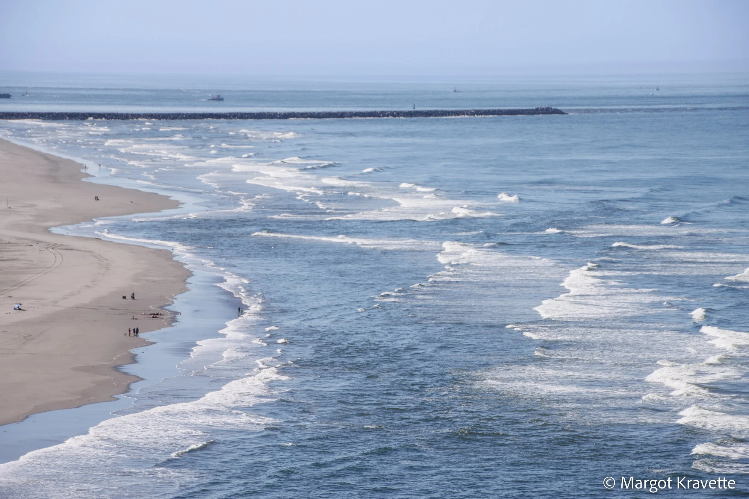
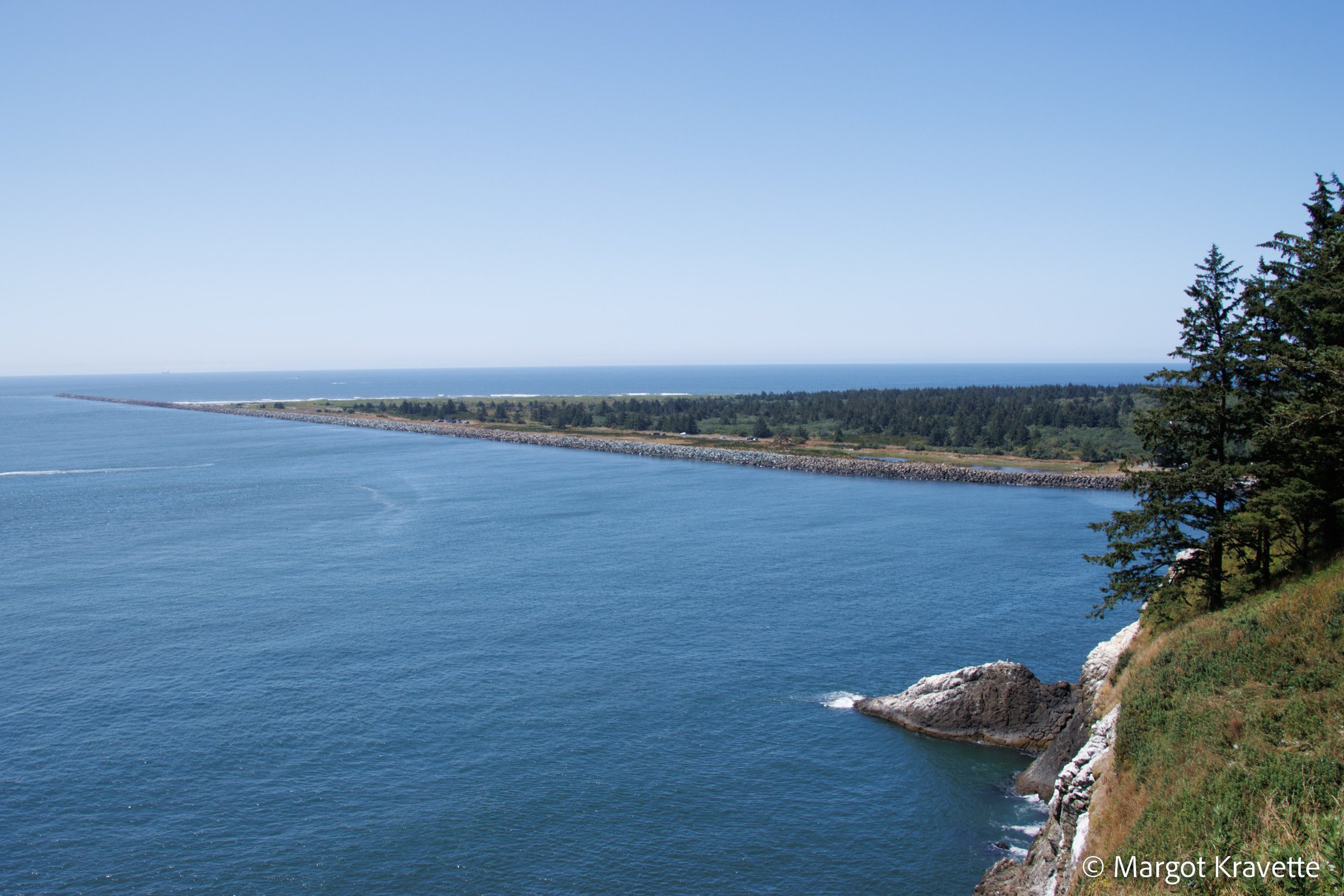
The mouth of the Columbia River was and continues to be so dangerous that early on it earned the nickname “The Graveyard of the Pacific”. The river’s water pours into the ocean at a rate of 1.3 million cubic feet per second, and the silt that builds up at the mouth of the river creates the bar. The water slams against the bar creating some of the most huge and forceful waves on the west coast. This certainly explains why, despite its 4 mile breadth, the early explorers didn’t find the river they were looking for. Although with modern technology, preventive measures have been taken to reduce some of the impact, extreme caution is still needed by seafarers.

There were times in Cape Disappointment’s history where it served as a home for the military. In 1852 a military reservation was established when seven smoothbore cannons were placed near the Cape Disappointment Lighthouse to protect the mouth of the Columbia River from potential attack by Confederate ships during the Civil War. These and other fortifications in that area became Fort Canby in 1875, and along with Fort Columbia and Fort Stevens, their role was to protect the Columbia River. One of the earliest forts in American history, Fort Canby was named after General Edward R. Canby who had been killed fighting Indians in California in 1873. The Fort stayed active until World War II when the park was renamed Cape Disappointment State Park.
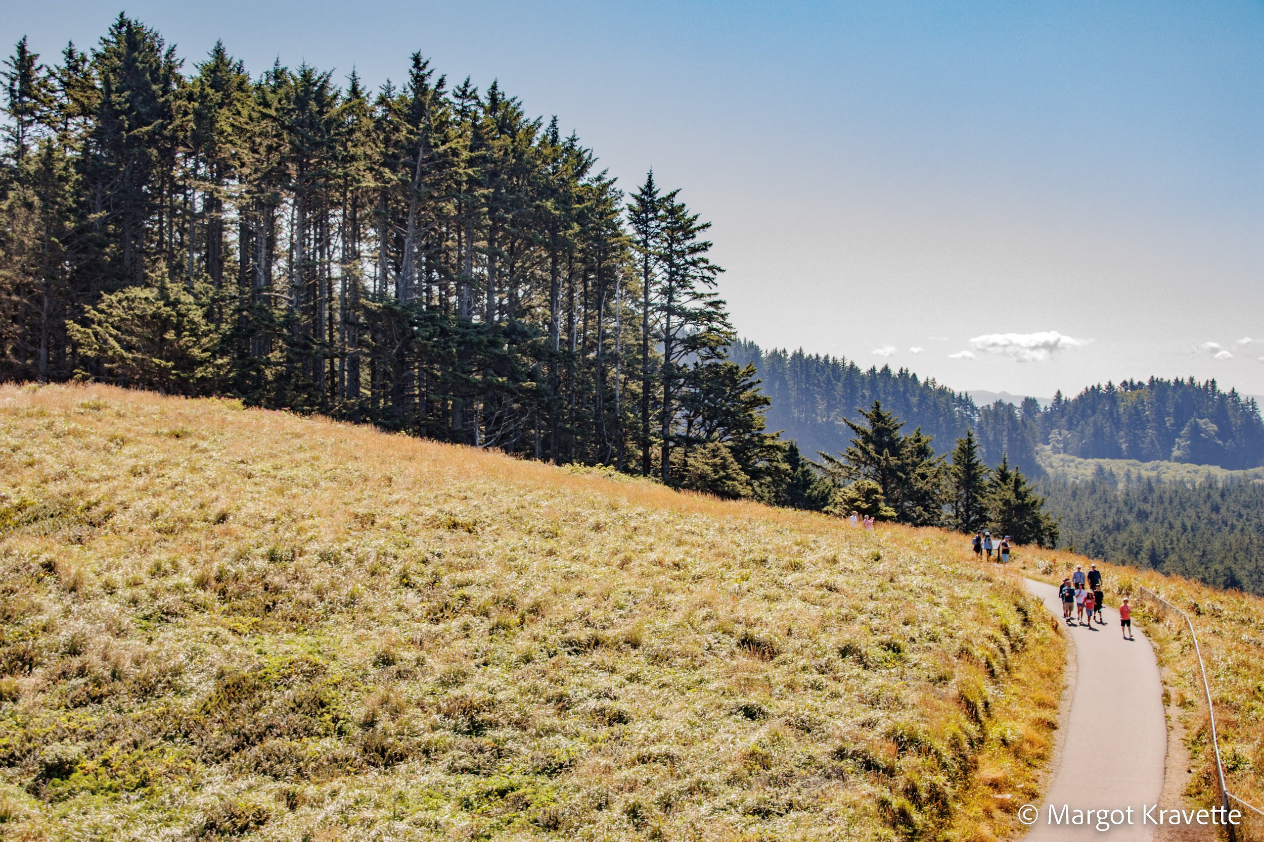
Cape Disappointment State Park has 12 miles of trails. In addition to the North Head Loop and the Bells Overlook Trail, we took the Cape Disappointment Trail which took us to the Cape Disappointment Lighthouse, the Lewis and Clark Interpretive Center, Deadman’s Cove, a view of the North Jetty, and past the US Coast Guard Station.
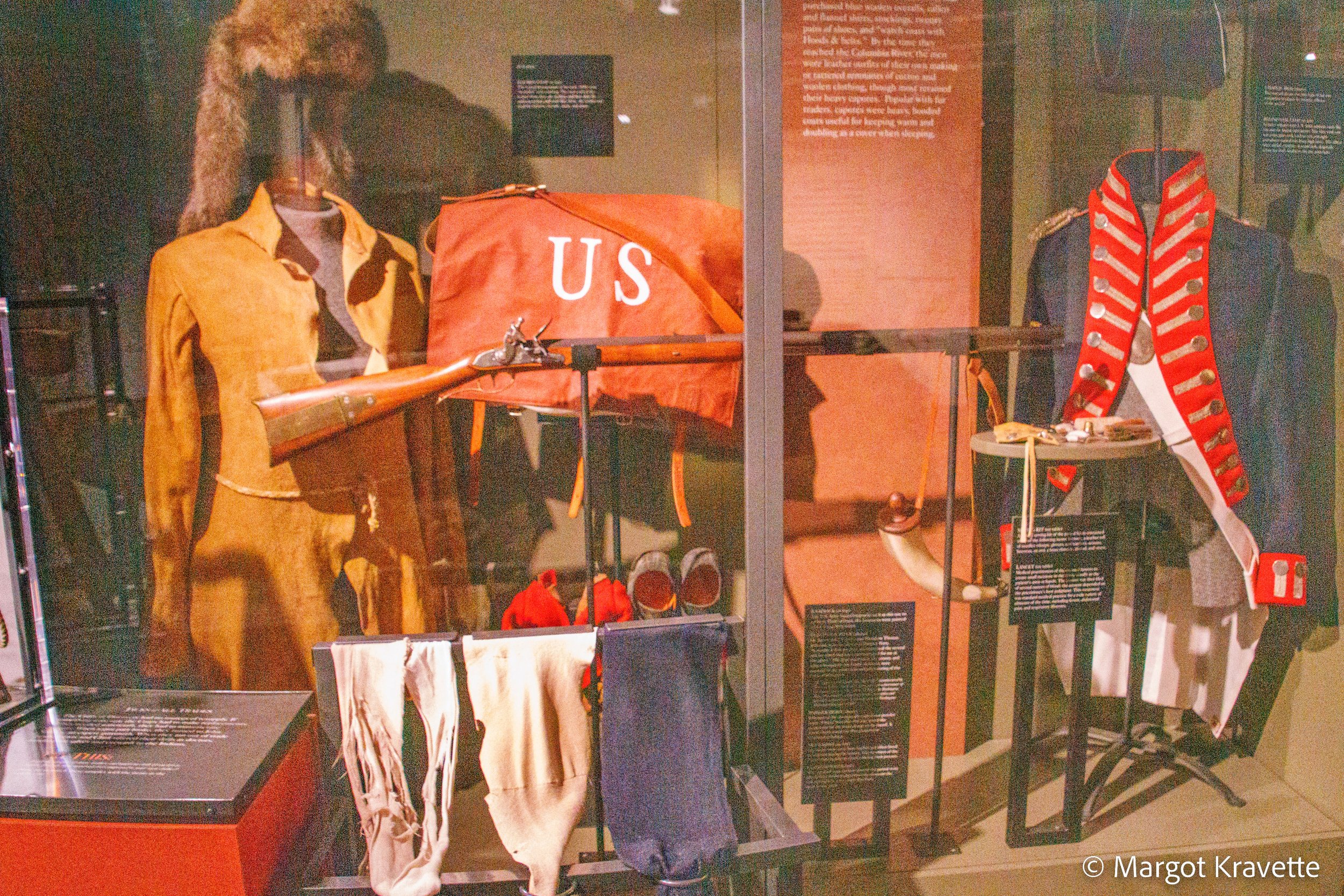
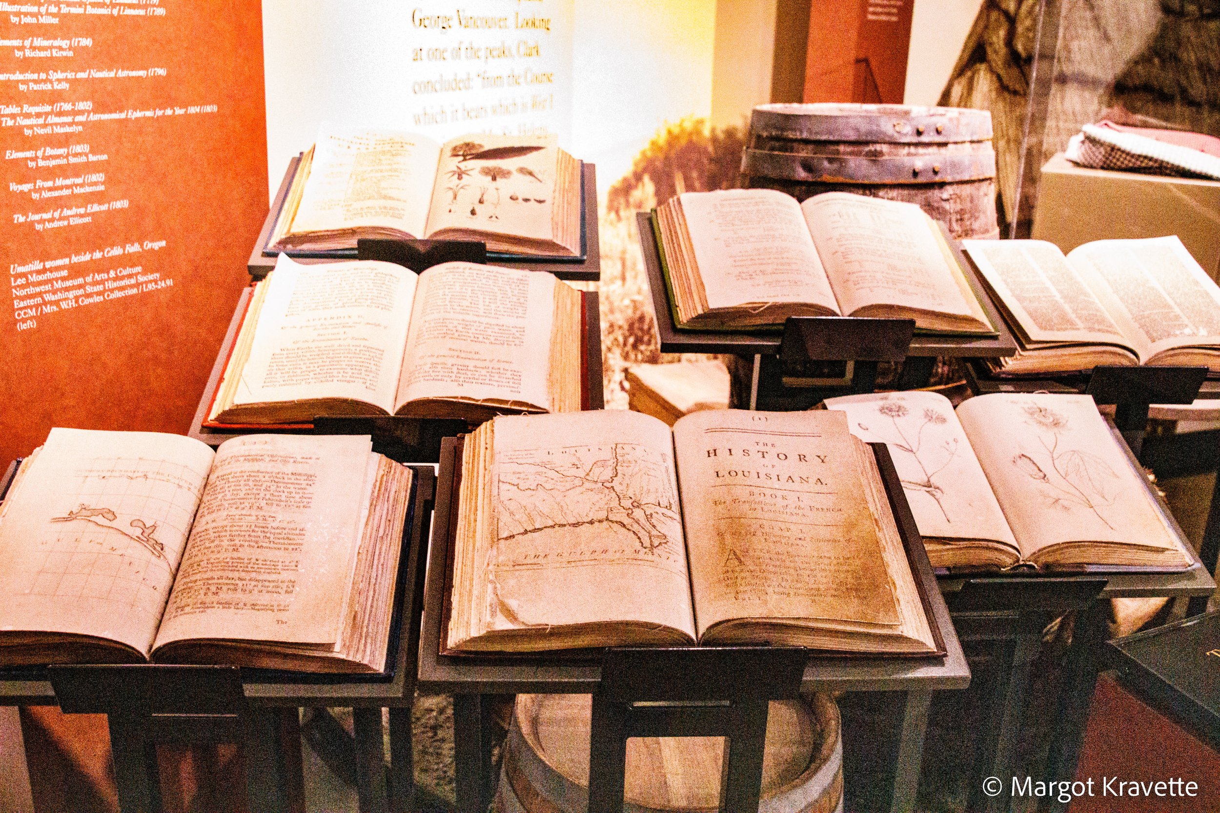
The Lewis and Clark Interpretive Center has a range of exhibits including artifacts from their journey, paintings, maps, books and a 15 minute film that provides a good overview of the journey. The west side of the Center has a glass wall that provides an expansive view of the water. The outside plaza faces the same direction, providing the same view, but even better when I caught an image of an eagle.
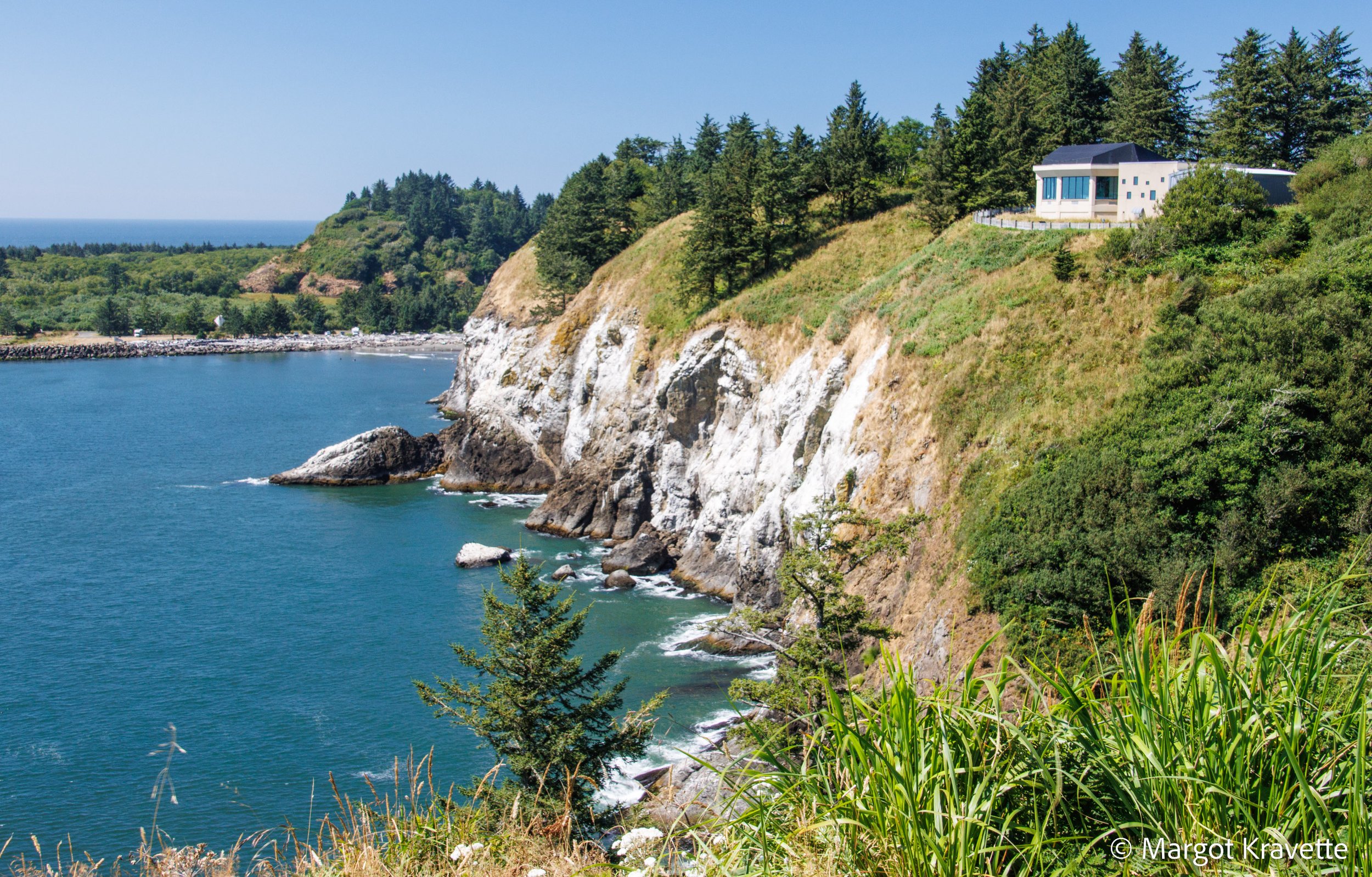
As we walked through the lush forest on our way to the Cape Disappointment Lighthouse, we discovered Deadman’s Cove. The trail was on the upper part of the cove and getting down to the beach required descending a very steep area where there was only a ragged set of rock steps, so we decided to just admire its beauty from above. The water was so colorful and sparkly it didn’t look real. The cove is named for the men that died on the bar and whose bodies were washed up on the beach. Kind of an eerie story but a beautiful spot.

The Cape Disappointment Lighthouse, completed in 1856 and the first such structure in the Pacific Northwest, was constructed to warn sailors of the dangerous bar they were crossing where the Columbia River and the Pacific Ocean meet. Lighthouses were included as part of the 1848 Act of Congress establishing the Oregon Territory, In 1850 a coastal survey determined that one lighthouse was needed at Cape Disappointment as the entrance to the Columbia River, and the other at Cape Flattery, as the entrance to Puget Sound. Due to the extreme fog that occurred regularly, a 1600 pound bell was also installed to provide an audible warning, nine times every minute, that sailors could rely on if they couldn’t see the light. This lighthouse is still actively staffed so it is not open to explore, but the views of the ocean and of the Lewis and Clark Interpretive Center high on a bluff made up for it.
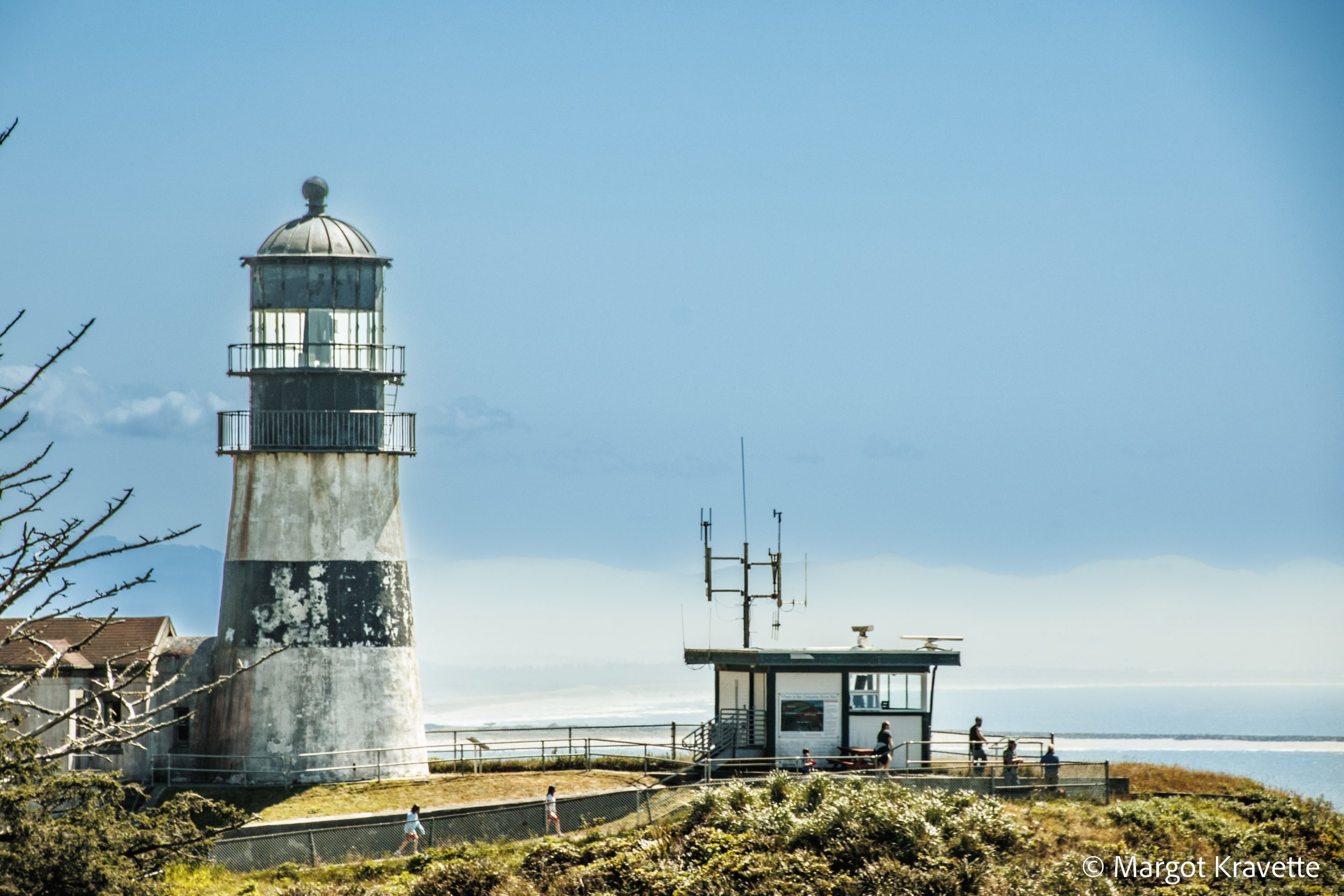

Unable to either hear the bell or see the light, sailors coming south along the west coast of what is now Washington State, had extremely poor visibility and shipwrecks occurred frequently. The Lighthouse Board asked Congress for money to build a second lighthouse, and the North Head Lighthouse lit up for the first time in 1898. With the lighthouse situated on a high bluff, the walk toward it was exciting as we anticipated getting closer to the vast Pacific Ocean. Of the two lighthouses, the North Head Lighthouse was the only one we could climb to the top, and it was an easy climb compared to others we did recently.

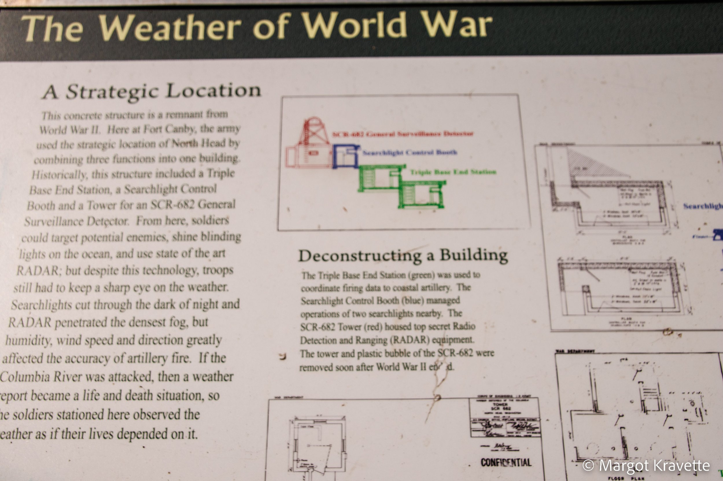
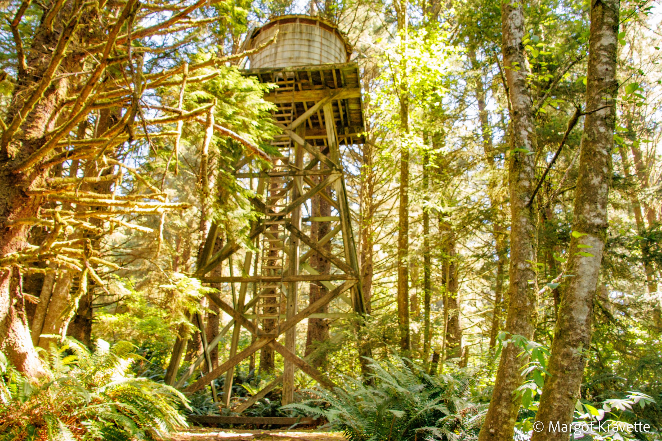
A hike to the Bells Overlook that starts at the same parking lot as the trail to the North Head Lighthouse took us through one of the areas of Fort Canby’s expansion and the first protected area of Cape Disappointment State Park . We noticed a bunker that had been used for scanning the coast during World War II, and an old water tower remained from its days of activity. Along the trail through a lush forest there are informational signs about Cape Disappointment’s role in weather prediction, martial protection, and history. The trail ends at a small boardwalk with a gorgeous view of the Long Beach Peninsula and the Olympic Mountains.
One site we missed in the park is the western most location of the Confluence Project, which connects viewers to the history, living cultures and the ecology of the Columbia River through Indigenous voices. There are a total of six art landscapes where artist Maya Lin, who designed and created the Vietnam Memorial in Washington, D.C., collaborated with Northwest tribes and communities to bring these messages to the public. The project follows Lewis and Clark’s journey along the Columbia, ending at Cape Disappointment where the explorers completed their trip. I look forward to exploring all six locations once they’re all completed.