The Grand Coulee
During the last Ice Age, a vast continental ice sheet covered southwestern Canada and northern parts of Washington, Idaho, and Montana. One lobe of the ice sheet descended into the Idaho panhandle, blocking the Clark Fork River with an ice dam thousands of feet thick. Water rose behind the dam, flooded the valleys of Montana creating the Glacial Lake Missoula – a great inland lake stretching over 200 miles to the east. Water rising behind the dam flooded the valleys of Montana, creating Glacial Lake Missoula – a great inland lake stretching over 200 miles to the east with a volume of water greater than Lake Erie and Lake Ontario combined.
The rising lake waters periodically caused the ice dam to fail, resulting in sudden, cataclysmic floods that rushed across northern Idaho, eastern and central Washington, through the Columbia River Gorge and into Oregon’s Willamette Valley, before emptying into the Pacific Ocean at the ancient mouth of the Columbia River. Glacial Lake Missoula would have drained in just a few days as a volume of floodwaters greater than all the rivers of the world combined roared up to 60+ miles per hour. This happened dozens, maybe hundreds of times as the advancing continental glacier build a new dam.
Our Cataclysmic Floodscape Brochures. Ice Age Flood Institute
Material taken in large part from On the Trail of the Ice Age Floods: A geological field guide to the Mid-Columbia, by Bruce Bjornstad, 2006, Keokee Books, Sandpoint, Idaho.
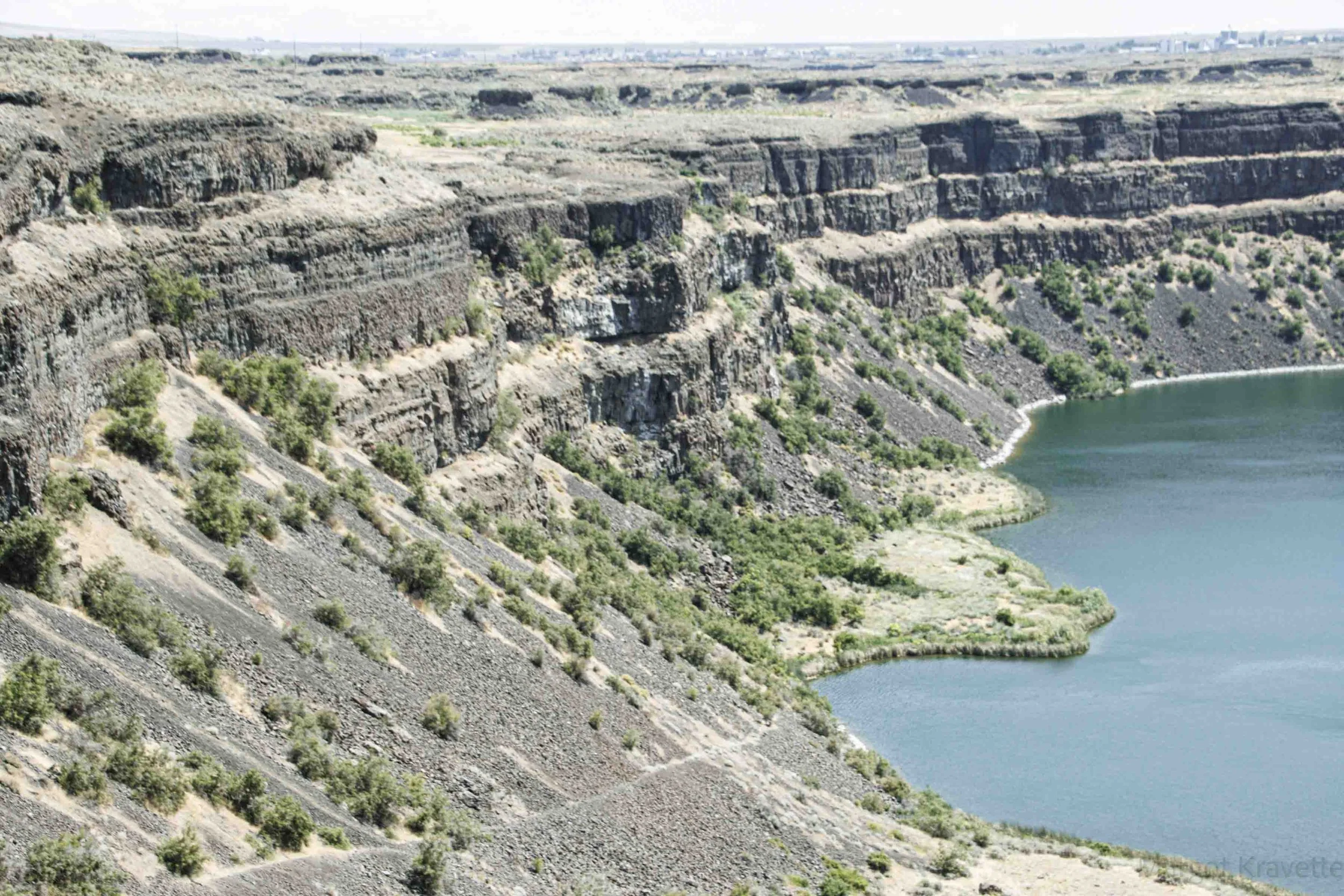
The places we visited on this journey were in Grant County in Washington along the Grand Coulee that stretches about sixty miles from the Grand Coulee Dam to Soap Lake. The Grand Coulee is an ancient river bed in the Columbia River Plateau. The deluge of flood water stripped away soil, cut deep canyons and carved out 50 cubic miles (210 km3) of earth, leaving behind areas of stark scabland.
Scabland: The irregular land surface of bedrock and thin soil that has been scoured of its soil by floods.
Coulees: Canyons: Characterized by steep walls that have been shaped by erosion.
Grand Coulee Dam
Why was the Grand Coulee Dam built in the first place? Thousands of acres that were unable to be used for agriculture because it had no access to enough water as their rainfall was about 6 inches annually. Hydropower is the main purpose of the dam now, the need for irrigation was at the top of the public’s mind at the time. The purpose of the Grand Coulee Dam has expanded to flood control and river regulation and water storage and delivery, including irrigation, power generation, recreation, and fish and wildlife.
The Grand Coulee Dam is the largest hydropower producer in the United States, generating more than 21 billion kilowatt-hours of electricity each year. That’s enough power to supply 2 million households with electricity for one year. The dam supplies power to 8 states: Washington, Oregon, Idaho, Western Montana, and parts of California, Utah, Wyoming, and Canada.
The best way to understand the history and construction of the dam is to watch this video that was created to tell the story of the dam from its inception. Grand Coulee Dam: A Man Made Marvel describes the details of approval, construction, and the functional growth over almost a century. It’s a fascinating story.
When I first saw the Grand Coulee Dam it was overwhelming. It is SO big – one of the largest structures in the world. The height of the dam is 550 feet, and its length from one end to the other is 5,223 feet. A mile is 5,280 feet! 12 million cubic yards of cement were used in building the dam. That’s enough to build a highway from Seattle to Miami. There are four buildings – three power plants and a pump-generating plant. We were fortunate to go on a guided tour of the dam including the John Keys III Pump Generating Plant. It has 6 pumps that exclusively move the water from the Columbia River up the hillside to a canal that flows into Banks Lake, which provides irrigation to the 670,000 acres in the Columbia Basin Project. 6 other pumps do the same, but they can be reversed to generate hydroelectricity when needed. Fortunately the needs for irrigation and for power are in opposing seasons so they don’t compete with each other.. Following this part of the tour we were able to walk on top of the dam where we had amazing 360 degree views. In the evenings during the summer,, a 30 minute laser light show describes the human and natural history of the river, and so much more.
Northrup Canyon
The trail we followed dips down into the canyon which holds the only native forest in Grant County, with mostly pine, but also some Douglas fir. With all of these trees, it is a logical site for birds of many kinds, making my companion, Sheryl, extremely happy. I, on the other hand was satisfied with seeing deer, a few marmots, and a snake. I don’t know what kind of snake it was, but since Eastern Washington is known for having rattlesnakes, I was careful to stay away from it. However, I was too close to swarms of mosquitos that were attracted to every uncovered part of my body and left me itching and scratching for several days.
Steamboat Rock and State Park
We weren’t planning on a hike on our final day, but we couldn’t resist exploring Steamboat Rock, known as the crown jewel of the area. Other than the Rock, the park itself has multiple camping and hookup sites as well as plenty of recreation space for both land and water. The hike to the rock’s 600-acre flattish top was described as steep, rough, and rocky. We decided against that option and instead walked partially around its perimeter on a sandy trail through sagebrush and arrowleaf balsamroot. The rock, a columnar basalt rock butte, sits 800 feet in the air in the middle of Bank Lake, connected by an isthmus. On top you can choose between two trails, the northern trail (3 mile) or southern trail (2.5 mile), or you can take the 4-mile trail around the entire table. I have read that the views from all points are breathtaking.
Dry Falls
When the Ice Age Floods occurred about 15,000 years ago, the waters filled what was Glacial Lake Columbia and flowed down the Grand Coulee. The second of two major waterfalls, what is now Dry Falls, was formed. The falls spanned 3.5 miles across, with 400-foot drop, four times the size of Niagara Falls. But once the ice sheets melted, these falls and the Grand Coulee were left dry. Rather than seeing flowing water, when you look at the Dry Falls from the Visitor Center tall windows, over the fence in the parking lot, or down in the basin of the falls you see towering basalt cliffs, rock formations, erratic structures, pot hole lakes, and the place where the Falls had been thousands of years before. What looks like a wall around the lake is part of where the falls dropped so many years ago.. Can you imagine? The beautiful grass that grows around and in the small lakes and streams remains unnamed. It is soft and beautiful as it moves with the gentle winds. However, we were told by a Visitor Center worker that they have had several botanists try to identify the grass, but were all unsuccessful. The Visitor Center has very informative and helpful displays that tell the story of the floods and how they impacted the Pacific Northwest.
Lenore Lake Caves
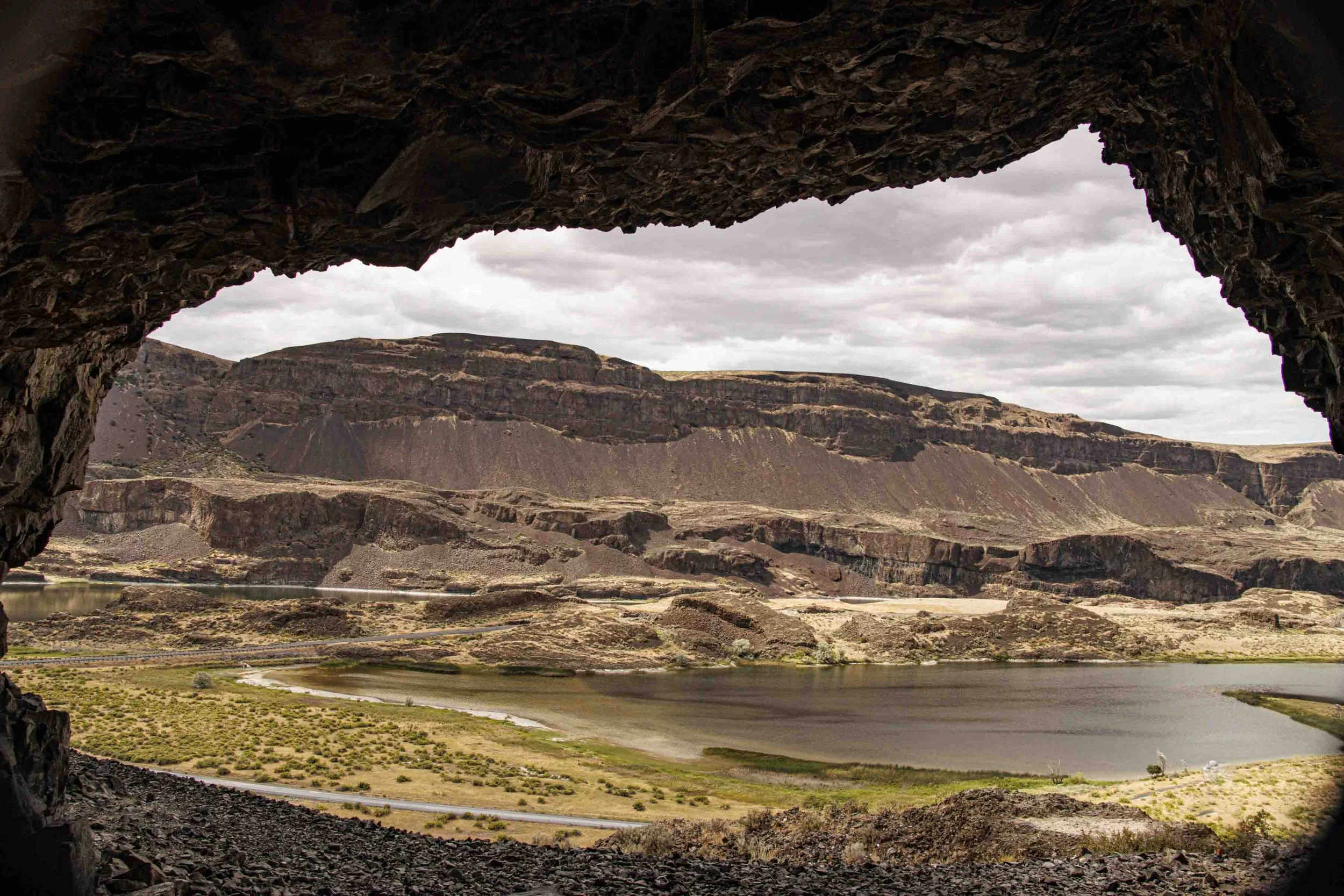
Almost 10 miles from Soap Lake are the Lenore Lake Caves, formed from the coulees long after the flood waters had receded. The Native American tribes had used the area to hunt, fish, and collect plants, and the caves served as some of their base camps. The caves are still used today for several Native American religious ceremonies.
The floors of the caves sit 150 feet from the ground. Our hike started with a long staircase carved from a big rock, then finished with poured concrete. From the top of the staircase, we turned right as recommended by multiple resources, and continued on a dirt path which ultimately ended on rocks that had broken off and fallen down toward the slopes below. We still had a way to go to reach the caves and the rocks on the ground were loose and slid easily. The caves are wide, but shallow. Looking around at the ceilings and walls of the caves you get a better understanding about what they are made of and what came before. There are a total of 7 caves, a 1.5 mile round trip. When we were finished, we found our way and were quite relieved to find the staircase that took us down to the parking area.
Soap Lake
The small town of Soap Lake, with a 2020 population of 1691, was known as “Smokiam”, meaning “healing waters” by the early Native Americans. It was later incorporated in 1919 as Soap Lake. Of the five lakes in the Coulee Corridor that were created by the Ice Age Floods (Lenore, Soap, Banks, Rufus Woods , and Franklin D. Roosevelt Lakes (Idaho), Soap Lake has the highest mineral content. With its 18 different minerals Soap Lake stays concentrated because the lake is at the far end of the Grand Coulee Dam and has no outlet. People have come from all over the world to treat their ailments with mud from the lake, hoping for rapid and complete healing.
Since the lake stays very shallow quite a long distance from the shore, it appears to be common for visitors to bring beach and lounge chairs into the water and relax there as the mud is doing its trick. Sheryl walked out into the lake about 50-75 feet and the water was still below her knees. But, with another woman and her dog, they successfully found the mud by smooshing around with their feet, and applying it as needed. Fortunately, there were very good public showers.
Confederated Tribes of the Colville Reservation
For hundreds of years, until the 1800’s, Native American tribes lived in the area of the Columbia Plateau in the territory of Eastern Washington. In the 1850’s explorers and settlers came and put down their roots. Today the Confederated Tribes of the Colville Reservation consists of 12 different Indian tribes, 11 of which are in Washington state and one, the Nez Perce, is in Northeast Oregon. The Colville Indian Reservation is 2,300 square miles, about 1.4 million acres, about half of its original size, and has more than 9,000 members. The Colvilles, as they are known, are a progressive community, governed by their own administrative and judicial branches within the boundaries of the reservation. Their headquarters are near the community of Nespelem, the original home of the burial site of Chief Joseph, best known for his intelligence and for his peace keeping efforts.
The Grand Coulee is just one part of the Ice Age Flood story. As I explore other counties in Central and Eastern Washington I will share with you what I learn. There is A LOT to discover and to learn.


