The Palouse
The Palouse is one of the most spectacular places I’ve visited since starting Inspired Journeys . It is acres and acres of rolling hills primarily populated by farms and businesses related to the produce grown there. The colors of the rolling hills are influenced by the seasons, the crops planted, the weather, and the light coming from above. There are small farm towns interspersed throughout that have their own unique stories. The Palouse’s 19,000 acres sit primarily in Whitman County, but it extends into portions of Spokane, Columbia, Garfield, and Asotin counties as well. The Palouse’s eastern boarder spreads into Idaho, but is bordered there by the Idaho forests. Its southern boarder is defined by the Snake River as it winds down toward the Tri-Cities.

For millions of years, the Palouse was a bed of lava. Then, 1.6 million to 10,000 years ago, the Ice Age had the greatest impact on the land with glaciers covering it all. During that time there were strong winds that blew across the Palouse carrying silt with it. The glaciers ground the silt into a fine powder called loess, contained by most agricultural areas. The dune-like hills of the Palouse were formed by the settling of the silt with the rich and fertile loess.
Diane and I went to the Palouse in August of last year and again just recently at the end of May. We wanted to see the changes in the different seasons. Last year we spent about 75% of our time driving on rural, often dirt roads. The roads took us close enough to see the variety of crops and colors. Most of the farms had some combination of houses, barns, silos, and animals. This year we spent a lot of time exploring some of the small towns and catching up with places we had missed the first time.


It was amazing to me that the fields have margins that define where one crop starts and another stops. Tractors and other farm machines are linked to GPS, enabling them to cut in straight or intentionally curved lines. These systems can chart the entire field and guide the equipment with extreme accuracy. The combination of advanced GPS technology, auto-steering systems, and accurate triangulation with base stations allows farmers in the Palouse to achieve the remarkably precise crop borders seen in the region's famous rolling hills.
The most common foods grown in the Palouse are grains, wheat and barley, legumes including lentils, peas, and garbanzo beans as well as canola, mustard and blue grass. The Palouse is the largest lentil growing region in the United States.
During early spring lighter greens dominate with the crops having short stems as they start to grow. The most copious wild flowers and crops are most abundant through May and June, and it is at that time when the green color in the fields darken and look like velvet. During spring and early summer canola spreads its bright yellow color across the fields. It was still early for the canola during our last visit, but finally on our last day the bright fields finally glowed yellow for miles.


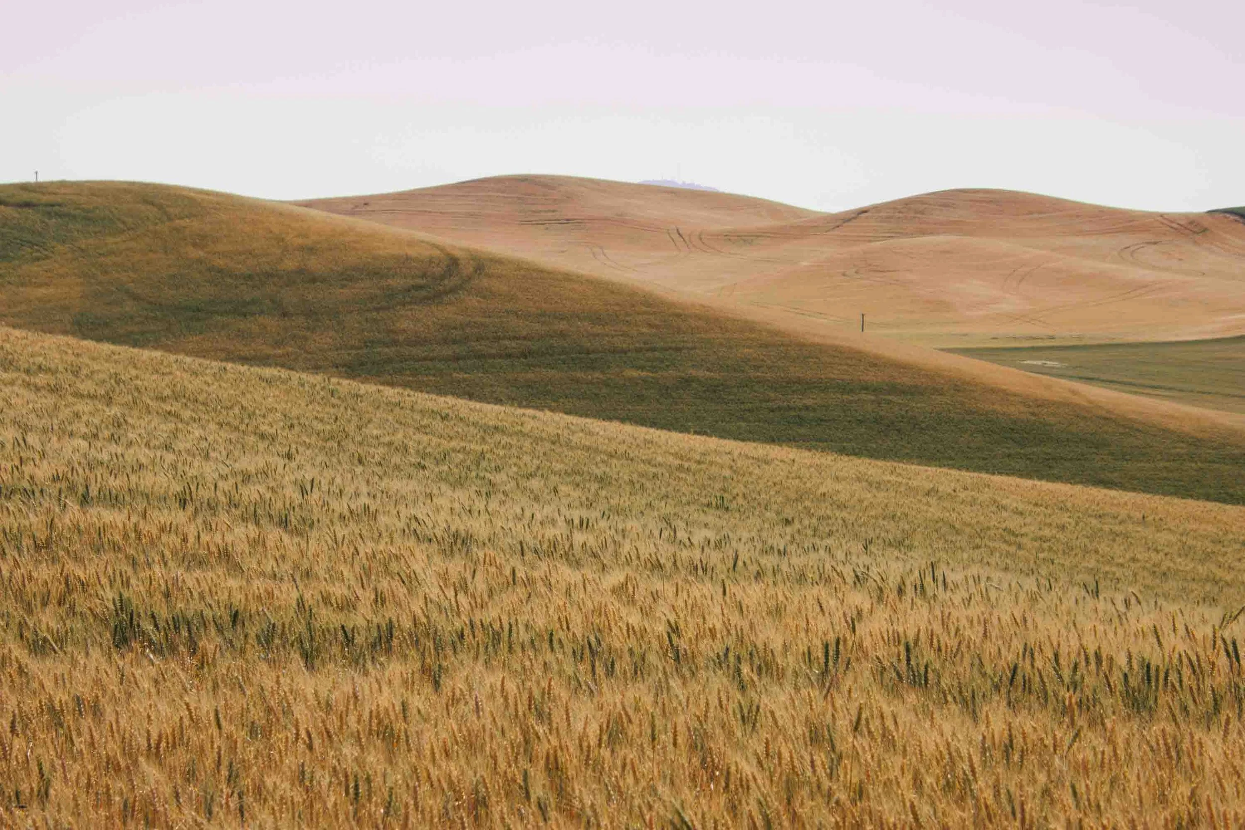
Starting in late June to early July the rich green crops and grasses begin to change to golds and browns and the farms will begin to cut hay fields, leaving the enveloped rows of grasses to dry in the sun. The wheat and the barley harvest starts around mid-July through late August depending on its location. The other crops continue through September. In early fall farmers plow their fields and plant winter crops.
Steptoe Butte, part of the State Park Heritage Site is the most recommended place to visit and to understand the scope of the Palouse. A “Steptoe” is a geological term describing an isolated peak surrounded by lower-lying lava flows. Below sea level, Steptoe Butte is submerged somewhere between 1500-2000 feet in cooled lava. Its 3600 feet high peak and its narrow, winding roads allow you to get to the very top. From there you have beautiful panoramic views of farmlands, mountains, and even other states such as Oregon and Idaho. The higher you go, the large expansive farms and the colors start looking like tiny pieces of a huge jigsaw puzzle. We went to Steptoe Butte twice on our first trip – once during the day to get familiar with its route, and again in the later in the day. The evenings are the best time to go when the sun is at a low angle creating amazing shadows and views that are indescribable.


Unfortunately, on our most recent trip, access to both Steptoe Butte and Kamiak Butte, were both closed for road repair. Not having access to Steptoe Butte, we asked several people if they were aware of any elevated areas that would give us a great view of the Palouse. We first followed directions from a very nice man who suggested we cross the border into Idaho. We tried his idea but never found the mountain he spoke of without going farther into Idaho than we preferred. Later, a young women working at the WSU Library’s information desk directed us to an elevation on the campus, not far from the library. That location gave us an unobstructed view of many farms and surrounding mountains. Not quite as high as Steptoe, but a good view nonetheless.


We had an unexpected surprise when we read about WSU’s Research, Education, and Conservation Bear Center, the only such place in the United States. Prior to the establishment of the Bear Center, both federal and state biologists responsible for understanding and managing wild grizzly bears occasionally wanted to use captive bears in their studies. In their attempts to use bears in zoos, biologists found that few zoos have the resources or sufficient sample sizes of bears to obtain meaningful data. This cap.tive bear facility currently has 6 indoor-oudoor dens/runs and a 2.2-acre exercise yard. Bears are rotated into the yard on a daily basis. We followed the guidance on line to visit the bears in the evening, and found four of them walking around their caged area, and one sitting in his tub playing with his red ball. Visitors are protected from the bears by two sets of fencing which not only prevents them from potentially hurting us but also make taking photos very difficult.

The serene rolling farm lands are some of the most magical areas in Washington State. Whether you see it from the top of a butte or on the ground it will take your breath away.
